- This topic is empty.
-
AuthorPosts
-
2026-08-18 at 7:11 pm #10286
Understanding the Challenges of Modern Groundwater Exploration
Locating potential groundwater resources is often constrained by the practical limitations of field investigation. Drilling without sufficient subsurface information can be labor-intensive and costly, while geophysical surveys must be designed around local geology, terrain, noise conditions, electrode contact, and the target depth.
For organizations assessing aquifer potential, selecting candidate drilling areas, or planning rural water-supply projects, the key challenge is not simply collecting more data. It is obtaining geophysical information that can be interpreted together with hydrogeological conditions, existing well records, and—where drilling proceeds—subsequent drilling and pumping-test results.
Geomative Co., Ltd., headquartered in Shenzhen, China, provides geophysical equipment and related digital tools under its “Geophysics+” concept. Its product portfolio includes electrical resistivity systems, field power supplies, and data-management tools for groundwater investigation and other subsurface applications.
Geomative’s Electrical Resistivity Approach to Groundwater Investigation
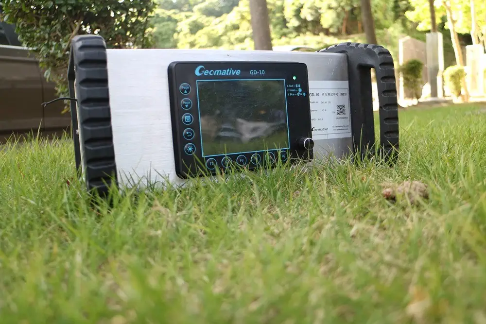
GD-10: Flexible Electrical Resistivity Surveying
The GD-10 is a single-channel electrical resistivity and induced-polarization system for subsurface electrical surveying. It can support Vertical Electrical Sounding (VES) and 2D Electrical Resistivity Imaging (ERI) applications; available measurement modes and dimensional capabilities should be confirmed according to the selected system configuration.
For groundwater investigation, resistivity data can help survey teams assess changes in subsurface electrical properties and identify areas that may warrant further hydrogeological interpretation. Low- or high-resistivity anomalies alone do not confirm the presence, depth, yield, or water quality of an aquifer; those conclusions require correlation with local geology, boreholes, water samples, and pumping tests.
GD-20: Multichannel Acquisition for Larger Survey Programs
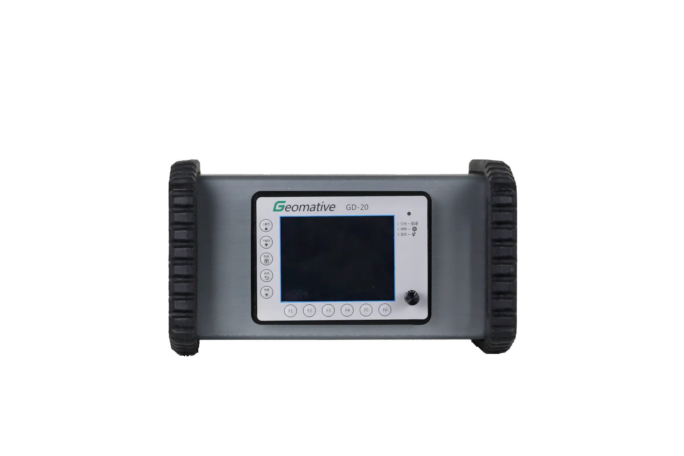
For projects involving multiple survey lines or tighter field schedules, the GD-20 multi-channel electrical resistivity system is designed to improve field-testing efficiency.
The GD-20 uses an independent 5/12-channel design. Depending on the survey mode and configuration, it can support up to 10 ERT acquisition channels and up to 12 sounding points. Geomative states that its average field-testing efficiency can be 2–3 times that of single-channel equipment under comparable conditions.
The system supports resistivity, induced-polarization, and related electrical survey applications. Its 3D ERT and IP capabilities should be selected and configured according to the project’s survey design, electrode layout, target depth, and interpretation requirements. For groundwater projects, multichannel acquisition can help shorten field collection time, but it does not replace hydrogeological validation.
Deep Exploration in Complex Terrain: A Field Case in India
Groundwater surveys in hilly and geologically complex terrain require particular caution because resistivity responses may be influenced by weathered rock, fractures, lithology, topography, and moisture conditions.
In Morena district, Madhya Pradesh, India, a GD-10 Supreme+ system was used for a hydrogeological investigation in hilly terrain. The survey integrated 1D VES and 2D resistivity imaging to map subsurface electrical conditions.
Importantly, the documented conclusion did not identify a major aquifer within 150m depth. The case report states that surrounding hydrogeological conditions suggested a confined aquifer might be present below 150m, while low-resistivity layers within the investigated interval could indicate saturated weathered shale or sandstone layers with seepage potential.
This case is therefore best presented as evidence of the GD-10 Supreme+ system’s use in subsurface mapping under complex terrain—not as verified proof that the system identified an aquifer beyond 150m.
Data Management as Part of the Field Workflow
Geomative Studio is presented as a geophysical data-management platform associated with the company’s electrical survey workflow. In field applications, structured data management can help teams organize survey information, review acquisition records, and transfer data into appropriate interpretation workflows.
For resistivity and IP investigations, final interpretation should be performed using suitable processing and inversion tools, alongside local geological and hydrogeological information. A digital platform can support data handling, but it does not by itself guarantee interpretation accuracy or groundwater success.
Matching Field Power to Survey Requirements
Electrical surveys require power arrangements suited to the selected instrument, electrode layout, survey method, and field conditions. Geomative’s power-supply portfolio includes BP-series DC power sources and the GP-5000 high-power rectifier.
The GP-5000 converts 220V AC input into continuously adjustable 0–1000V DC output, with a maximum output current of 5A and a maximum output power of 5kW. It is intended for projects that require high-power DC supply, subject to equipment compatibility and site-power conditions.
Power selection should not be based on depth alone. Effective survey performance also depends on electrode contact resistance, array geometry, line length, ground resistivity, environmental noise, instrument settings, and safety procedures.
Field Application: Rural Water-Supply Planning in the Philippines
In Barangay Concepcion Banahaw, Sariaya, Quezon, Philippines, a groundwater investigation was conducted to support deep-well planning for local water supply. The work included hydrogeological review and seven Vertical Electrical Sounding (VES) measurements.
Based on the georesistivity interpretation, the project identified three priority areas for possible well drilling. The report recommended approximate drilling depths of about 90m for Priority Site 1, up to 60m for Priority Site 2, and up to 100m for Priority Site 3.
These recommendations provided a basis for drilling planning rather than a guaranteed water-supply outcome. The case report specifically notes that actual well discharge or flow rate can only be determined after drilling and pump testing.
The project illustrates how VES surveys can support the selection of candidate drilling areas when combined with local hydrogeological assessment and follow-up verification.
Why Groundwater Teams May Consider an Integrated Approach
For groundwater investigation, an integrated equipment approach can offer practical value when it aligns with the actual field program:
-
Single-channel surveying: GD-10 can support targeted VES and resistivity-imaging work where a flexible field setup is required.
-
Multichannel acquisition: GD-20 can be considered for larger or time-sensitive survey programs where improved field-testing efficiency is important.
-
Appropriate power selection: BP-series supplies and the GP-5000 rectifier can be evaluated according to the selected instrument, method, and site-power conditions.
-
Structured data handling: Digital tools can support the organization and transfer of field data into interpretation workflows.
-
Independent validation: Drilling, borehole logs, water-quality sampling, and pumping tests remain essential for confirming groundwater conditions.
Geomative’s official website states that its solutions are deployed in more than 40 countries and regions, across 100+ industry applications, and are used by more than 1,000 clients worldwide.
Looking Ahead for Groundwater Exploration Practitioners
Groundwater exploration is most reliable when geophysical surveying is treated as one part of a broader decision process rather than as a standalone confirmation method. Electrical resistivity and IP surveys can provide valuable spatial information about subsurface conditions, while drilling and hydrogeological verification determine whether a target can support a practical water-supply project.
For teams evaluating equipment, the key considerations should include survey objectives, site geology, required depth of investigation, field efficiency, power availability, data-processing workflow, and the validation plan after interpretation. Geomative’s GD-10 and GD-20 systems provide different acquisition approaches that can be assessed within that broader, evidence-based groundwater investigation framework.
https://www.geomative.com
Geomative Co., Ltd. -
-
AuthorPosts

- You must be logged in to reply to this topic.